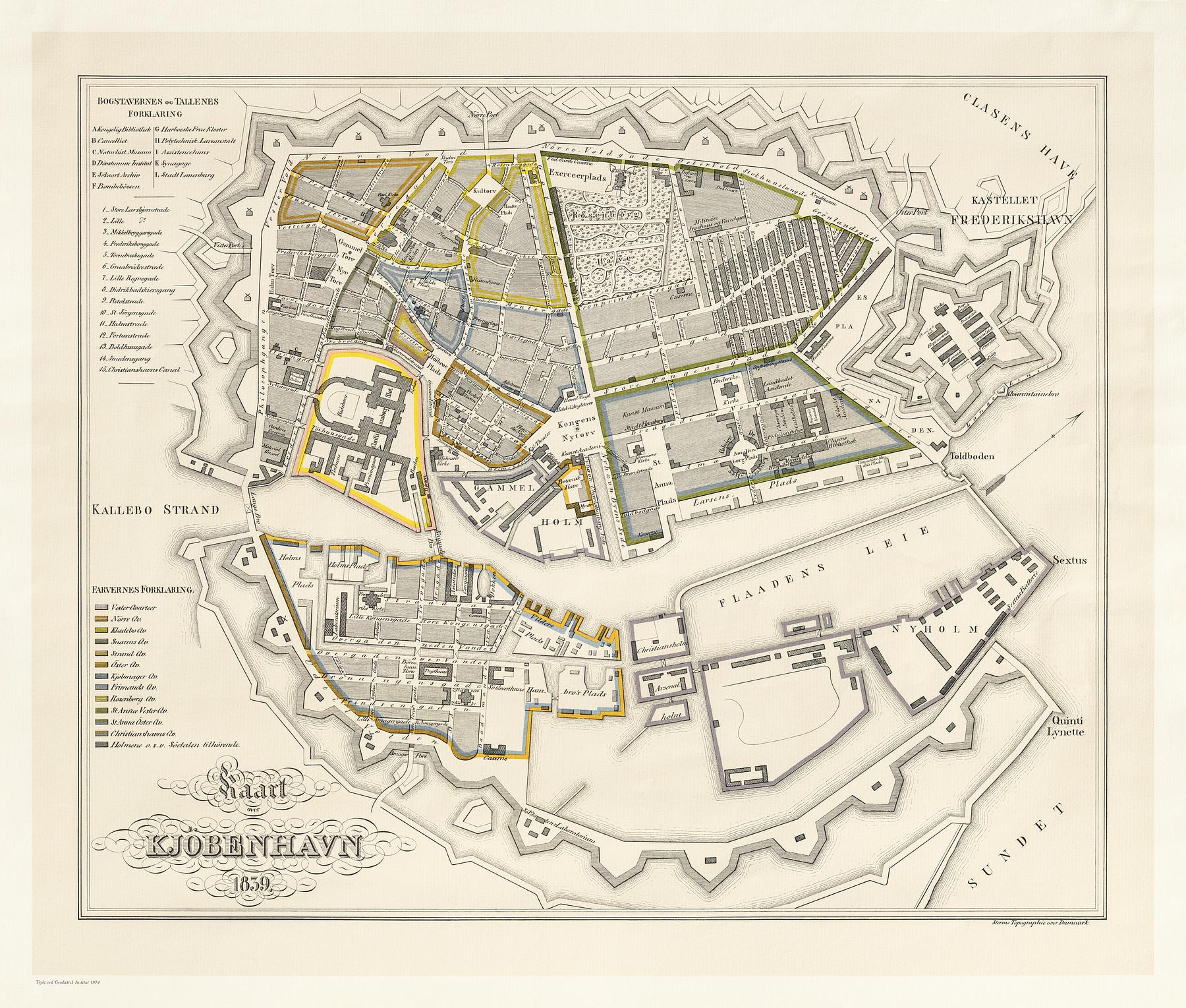
It was a small town of some 120,000 inhabitants to which Thorvaldsen returned in 1838. In addition to the Sound to the east, the city was defined by the ramparts, the jagged structures on the map, that defined its extent. The Town Hall Square is today at the absolute centre of the city. In 1838, on the other hand, it was outside the ramparts.
The important institutions of the absolute monarchy occupied large areas of Copenhagen in the form of palaces and the institutions relating to defence and the arts. The star-shaped citadel seen on the right of the chart was part of the Copenhagen defences. Christiansborg Palace, which burned down in 1884, is on the left along with the surviving semi-circular riding ground. In addition to the state apartments, the palace housed the Royal Collection of Art and the Collection of Antiquities. After coming home from Rome, the sculptors Hermann Ernst Freund (1786-1840) and H.W. Bissen (1798-1868) had had their homes and workshops in what was known as Materialgaarden in the area between Christiansborg and the ramparts. In Rome they had both worked in Thorvaldsen’s workshop. Thorvaldsen, on the other hand, lived and worked in the Royal Academy of Fine Art after coming home. This was a stone’s throw from the Naval Dockyard on Gammelholm – the light, triangular area at the centre of the map just to the right of Christiansborg. Here, too, there were sculptors working. They made figureheads and other decorations for the magnificent ships of the line.