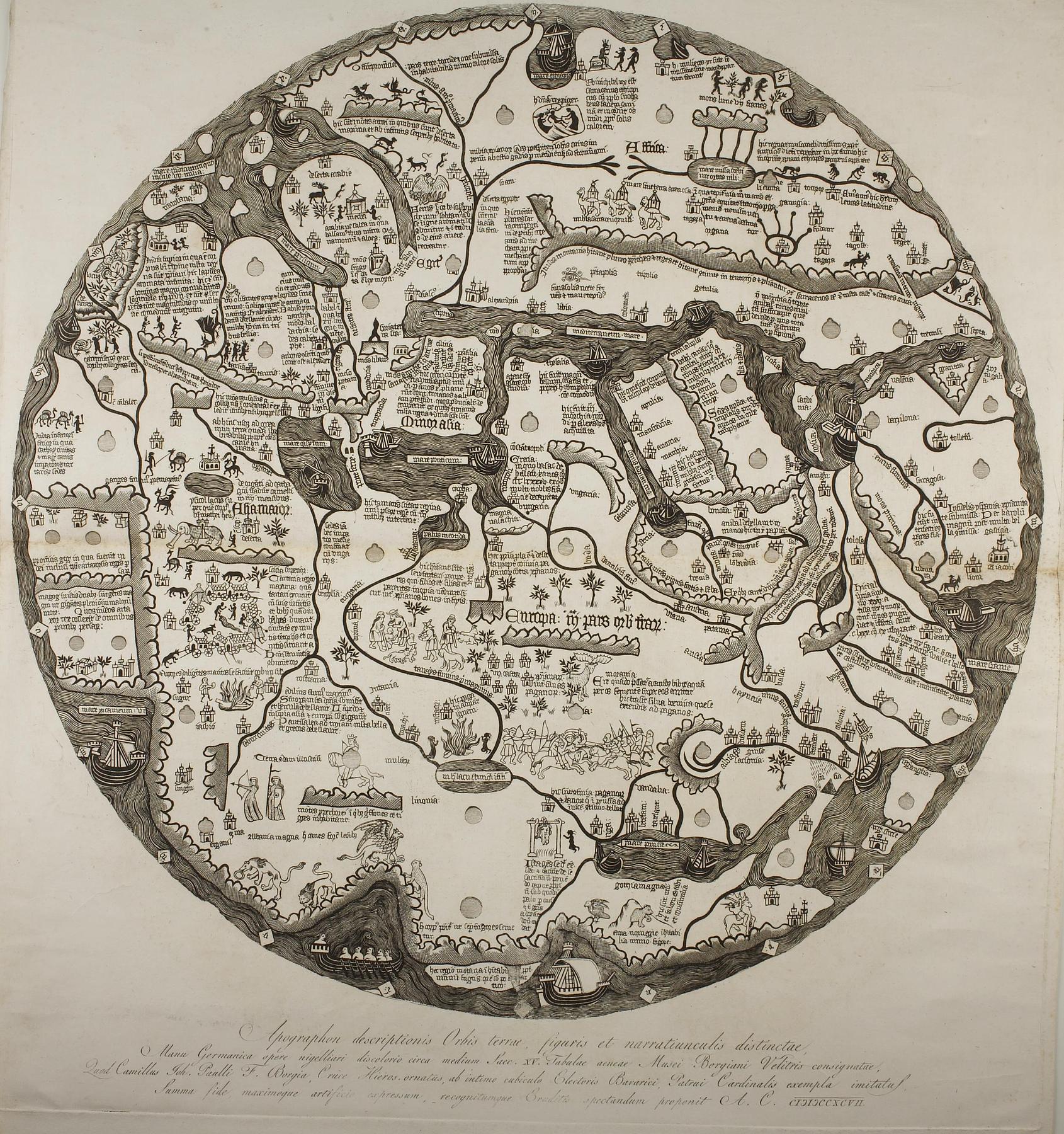
Historically speaking, map production has always been on the borderline between art and science. In former times, many maps were painted by hand with the use of watercolours. And in addition to its various utility functions, the map also served a decorative purpose. A map from the 15th century in the form of a copper plate was found in what, beneath his reproduction of the map, the engraver calls “Musei Borgiani Velitris”. This was a private museum at Velletri to the south of Rome, housing Cardinal Stefano Borgia’s (1731-1804) impressive collection. After the cardinal’s death, the collection was sold by his nephew Camillo Borgia (1773-1817) to the Museo Archeologica Nazionale di Napoli. The print is a reproduction of the map referred to above. Place names are included on the map – as on a modern map. But illustrative small figures such as elephants and reindeer also contribute to the understanding.
The 18th century saw the growth of a new interest in rational, measurable entities, which could be called scientific in our modern sense. Not the map, but this print of it, must have been made at a time when the picture of the world had changed. It belonged to Thorvaldsen. But the nature of his interest in the map is not known for certain. All we know is that one of the most important cartographers of the time, the German scientist Alexander von Humboldt (1769-1859) was a member of Thorvaldsen’s circle of acquaintances.
Apographon descriptionis Orbis terrea, figuris et narratiunculis distinctae, / Manu Germanica opere nigelliari discolori circa medium Saec. XV. tabulae aeneade Msei Borgiani Veletris consignatae /